C'wealth Department of Agriculture, Water and the Environment
Port Stephens LGA
2020
In response to community concerns, we were contracted by the Commonwealth Department of Agriculture, Water and the Environmment (DAWE) to undertake an independent assessment of the Brandy Hill quarry site between Seaham and Woodville to the west of Raymond Terrace. Of concern was a proposal to clear ~ 50 ha of Eucalypt woodland and the potential impact that this action may have on any resident koalas living in the area to be cleared.
Ipswich City Council
Ipswich Local Government Area, QLD
2020
We were awarded a contract to examine the status of threatened Brush-tailed Rock Wallaby (BTRW) populations in parts of the Ipswich LGA, our work involving a review of historical BTRW records to examine possible changes in the two key range parameters Extent of Occurrence and Area of Occupancy, working with Council officers to develop a field-based monitoring protocol, implementing a trial monitoring program and designing a BTRW database.
City of Gold Coast Council
City of Gold Coast LGA
2020
Successful long-term conservation of the koala population inhabiting the Burleigh Ridge to the east of the Pacific Motorway in the City of Gold Coast LGA is an important aspect of Council's long-term koala management objectives.
Ipswich City Council
Ipswich Local Government Area, SEQ.
2020
We were contracted by Ipswich City Council to undertake an assessment of habitat use by koalas across Council's Parks and Reserves, including the Mount Grandchester, Flinders-Goolman and White Rock-Spring Mountain Conservation Estates. The project involved a review of historical koala records to examine changes in koala distribution over time, as well as the application of SAT-based methodologies to quantify aspects of koala occupancy and metapopulation configuration in key areas.
IFAW (NSW Component) & WWF (Qld component)
NSW & Qld generally
2019
Much has been happened to koalas over the last few years, culminating in what could only be described as a catastrophic 2019/20 fire season. On behalf of the International Fund for Animal Welfare (IFAW) we recently completed a considered assessment of just how much habitat in NSW no longer contains koalas, how many have potentially been lost, from where and what the longer-term conservation implications are.
MidCoast Council and the Department of Planning, Infrastructure and the Environment (DPIE)
Kiwarrack, NSW
2019
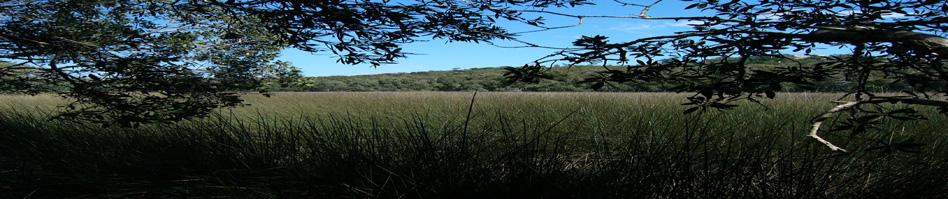
As part of on-going work for the Save our Species Iconic Koala Project we have been working to investigate the status of a potential 'koala hub' in the Bootawa area to the southwest of Taree on the mid-coast of NSW. Field work has confirmed the presence of an active koala source population that is largely mostly restricted to areas of farmland, the adjoining Kiwarrack State Forest being largely empty due to a long history of over exploitation.
NSW Office of Environment & Heritage
2019
We have been working with NSW OEH to develop a standardised field survey methodology that can inform on occupancy issues associated with the conservation and monitoring of Brush-tailed Rock-wallabies. Our initial survey work has been focused in the Watagans and Curracabundi National Parks located in elevated hinterland areas of mid-coastal NSW.
NSW Office of Environment & Heritage
Western NSW
2018
The critically endangered Red-lored Whistler is a small bird that occurs in the remaining mallee areas of western NSW. Our work for OEH has thus far involved a review of historical RLW records and available survey data, as well as the design of a survey program based on passive acoustic sampling at regular intervals across remaining areas of habitat which the species is known to utilise. The first formal survey based on our design will occur in the Spring of 2019. Watch this space.....
Port Stephens Council
Port Stephens LGA
2018
Following on from our 2017 work, we were engaged to undertake detailed koala hub assessments in the Tomago, Medowie and Kings Hill areas, all of which were identified as potentially supporting small, extant population cells. Unfortunately, field survey indicated little in the way of surviving population hubs in Tomago or Medowie. In contrast, Kings Hill is supporting an active source population.
City of Redlands Council
Redlands LGA, Queensland
2018
In collaboration with researchers from Universities of Queensland and Sunshine Coast we were contracted by the City of Redlands Council to undertake a koala habitat and population assessment across the Redlands, including Stradbroke Island. Amongst other things and supported by independent genetic studies, our work has confirmed a widespread distribution of koalas on the mainland, albeit at very low densities. This is a disturbing outcome given data indicating a koala population that numbered in the thousands little more than 15 years ago.
NSW Office of Environment & Heritage
Various locations throughout NSW
2018
We have been working collaboratively with the NSW Office of Environment & Heritage to convene and deliver a short course in Occupancy Assessment & Monitoring. Our first course was delivered in Newcastle in June, 2018 and others took place in Dubbo, Queanbeyan, Coffs Harbour and Hurstville. Assisted by OEH biometricians, the course offers an opportunity to better understand such things as key range / distributional parameters, how to design and implement occupancy-themed surveys and the utility of key occupancy metrics such as detection probability.
Clarence Valley Council
South Grafton
2018
Under the auspices of the Save our Species Iconic Koala Project we are working with Clarence Valley Council to investigate the status of koalas in a 63,000 ha area south of the Clarence River between Coutt's Crossing, Glenugie, Shannondale and Chambigne. Our job was to determine any changes in the distribution and abundance of koalas over time, to identify the locations of any local source populations or 'hubs', and to review available data regarding the potential risks posed by such things as disease, domestic dog attack and vehicle-strike.
NSW OEH
East Coast NSW
2017
We are continuing to work with NSW Office of Environment & Heritage (OEH) and the Koala Likelihood Model (KLM) by undertaking additional sampling in cells that currently have little or no information on koalas. To this end we are currently undertaking survey work in the South Pilliga, Warrumbungles National Park and extending into northern parts of Gilgandra Shire. The results to date do not bode well for koala survival in these areas.
Port Stephens Council
Port Stephens LGA
2017
We have been working with Port Stephens Council on several projects, the most recent of which was a Save our Species Iconic Koala Project report intended to establish a framework for the long-term sustainable management of koalas and their habitat across the LGA. Key areas for vehicle-strike have been identified, as have the locations of koala population 'hubs' and associated linkage / connectivity needs.
Darryl Anderson Consulting
Bilambil, NSW
2017
We are currently preparing a Vegatation Management Plan and associated documents for a development site in the Tweed. The site is located on volcanic soils and supports numbers of threatened plant species including Fine-leaved Tuckerooo, Spiny Gardenia, Marblewood and other species.
Lismore City Council
South-east Lismore
2017
We were contracted by Lismore City Council to design a long-term koala population monitoring program and provide a koala population estimate for the area covered by their approved Comprehensive Koala Plan of Management. Lismore has one of the highest disease-mediated koala mortality rates of coastal NSW, yet - anecdotally - koala numbers appear to remain quite stable. This will be the first time an estimate of the size of the local population has been undertaken; the work is being done as a component of an ARC funded project directed by Prof.
Council of the City of Gold Coast
City of Gold Coast LGA
2017
In 2017/18 we were appointed by the Council of the City of Gold Coast to reassess the Coomera - Pimpama and Coombabah koala populations. Using our original sites, this work involved resampling of remaining bushland areas, creation of new meta-population models, provision of a population estimate, analysis of mortality records and some population viability analysis.
Ballina Shire Council
Ballina LGA
2017
In 2012, the NSW Minister for Planning & Infrastructure initiated a review of the application of Environmental Zones (E Zones) and overlays in Local Environmental Plans on the Far North Coast of NSW. Amongst the implications arising from this review was the deferral of proposed land use zonings in some areas.
Byron Shire Council
Byron Coast
2016
In 2010 we undertook the first assessment of koala distibution and abundance in an area of the Byron Coast between Yelgun and Broken Head. In the latter half of 2016 we were engaged by the Byron Shire Counil to revisit each of the 63 field sites that underpinned our original study and so investigate changes to koala distribution and abundance that may have occurred over the intervening koala generation. Assisted by Council officers, we applied the principles of our newly developed Rapid-SAT methodology to the task.
South Gippsland Landcare Network
South Gippsland, Victoria
2016
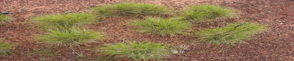
Over the last couple of years, various parties have been engaged in the collection of field data relating to habitat use by koalas across the South Gippsland area, including the Strzelecki Ranges. Over 1000 field sites have been sampled using RG-bSAT sampling protocols. We recently completed our analyses of the data and created a four-tiered koala habitat map for the study area. Amongst other things, analysis revealed a hitherto unknown species of preferred koala food tree - Strzelecki Gum E. strzeleckii.
Queensland Department of Transport and Main Roads (TMR)
Moreton Bay, Queensland
2016
On behalf of the Queensland Department of Transport and Main Roads we are working alongside other consultancies on the experimental design and implementation of a koala connectivity monitoring program for the Moreton Bay Rail Project between Petrie and Kippa-Ring in SE Queensland. The new rail line includes a range of underpass structures that will be monitored to evaluate their suitability for koalas using techniques such as GPS and radio-tracking, Wireless Identification Devices, trail cameras and thermal imaging cameras.
Environment Protection Authority
Koala Management Area 1 - NSW North Coast
2016
Species occupancy models are at the forefront of scientific/ecological endeavour.
Campbelltown City Council
Campbelltown, southwest of Sydney, NSW.
2016
For the past 12 months we have been working with Campbelltown City Council planning officers to prepare a Comprehensive Koala Plan of Management for the Campbelltown Koalas. Aspects of this project have included building on some of the earlier work by other parties, as well as undertaking more detailed analyses of historical koala records, revising the habitat mapping and working out how many koalas there are.
Forster, NSW
2016
We have recently been working down in the Great Lakes area surveying for the endangered Leafless Tongue Orchid and the diminutive New Holland Mouse, both of which are listed as Vulnerable for EPBC purposes. Using a grid-based approach, our work revealed two sub-populations of New Holland Mouse occupying habitat at optimum densities of nearly 20 animals/ha. The orchid does not appear to be present on our survey site, despite an intensive survey effort.
Ecosure Pty Ltd, NSW Roads & Maritime Services
Wardell, NSW.
2015
In August 2014 the Federal Environment Minister imposed conditions on Section 10 of the proposed Woolgoolga to Ballina Pacific Highway upgrade to the west of Wardell in north-eastern NSW, amongst which was the need to better consider the potential impact(s) of the intended upgrade on the local koala population by using Population Viability Analysis (PVA) modelling over a 50 year timeframe.
Qld. Department of Transport and Main Roads
Petrie, South-east Queensland
2015
On behalf of the Queensland Dept. of Transport & Main Roads we were engaged to review the specific components and relative merits of a suite of offset measures intended to compensate for the impacts on koalas arising from construction of the Moreton Bay Rail corridor. The proposed measures range across a variety of actions which are intended to be of direct benefit to the local koala population.
International Fund for Animal Welfare, National Koala Alliance
Victoria and South Australia
2015
Media attention has recently highlighted problems in Southern Blue Gum (Eucalyptus globulus) plantations in areas of Victoria and South Australia, wherein the treatment of koalas is cruel, inhumane and a national disgrace.
Client: Roadnet/Port Macquarie Hastings Council.
Location: Port Macquarie, New South Wales.
2014
Our recent koala habitat and population study across the Port Macquarie Hastings LGA for Port Macquarie Hastings Council identified Ocean Drive between the town of Port Macquarie and Lake Cathie to the south as a major koala black spot, this 20km strip of road accounting for 242 recorded deaths over the period 1975 - 2012.
Richmond Valley Shire Council
Richmond Valley LGA
2014
Towards the end of 2013 we were engaged by Richmond Valley Council to undertake a koala habitat and population assessment for eastern parts of the Richmond Valley LGA. In addition to collecting new information about the distribution and abundance of koalas across the LGA, the project also reviewed tree preference data gathered over a decade ago by the Australian Koala Foundation, along with more recent information from field surveys in drier forested areas to the west.
Ballina Shire Council
Ballina Local Government Area, New South Wales
2014
Following on from the recently completed Koala Habitat and Population Assesssment, we have also been successful in being appointed to work collaboratively with the Project Reference Group and Council officers in preparing a Comprehensive Koala Plan of Management (CKPoM) for the Ballina LGA. The CKPoM is expected to go on public exhibition early in 2015 and has been developed using concepts and approaches taken by existing planning models from the Northern Rivers area including Lismore, Tweed and Byron Coast areas.
Ballina Shire Council
Ballina Local Government Area, NSW
2013
Biolink was engaged by Ballina Shire Council to undertake a Koala Habitat and Population Assessment for the entire LGA, an area of approximately 50,000ha. Completed in the latter half of 2013, key outcomes from this study included identification of a historically significant koala population inhabiting the Blackwall Ranges and associated lowland habitat areas around Meerschaum Vale, Wardell and Bagotville.
Port Macquarie Hastings Council
Port Macquarie, NSW
2013
Biolink was engaged by Port Macquarie Hastings Council to carry out a Koala Habitat & Population assessment for the entire LGA. The project included analysis of historical koala records and on-ground field surveys, identification of preferred food trees and subsequent habitat modelling.
NSW Roads & Maritime Services
Tweed & Byron LGAs, NSW
2013
This project examined factors contributing to ongoing koala road mortalities along a 50km section of upgraded Pacific Highway between Chindera in the Tweed LGA and the Ewingsdale interchange in the Byron LGA. Analysis of 15 years of koala road-kill data, the presence/absence of fencing, fence types and associated issues such as maintenance were examined.
Byron Shire Council
Byron Local Government Area, NSW
2013
Following on from the recently completed Byron Coast Koala Habitat Study we were contracted by Byron Shire Council to prepare a Comprehensive Koala Plan of Management for the study area. Developed in conjunction with a Project Reference Group over a 2 years period, the draft CKPoM proposed a number of novel precedents for koala conservation and management including identification of Koala Management Areas and associated Koala Management Precincts wherein management effort can be focussed.
Coffs Harbour City Council
Coffs Harbour Local Government Area, NSW
2013
Biolink was engaged by Coffs Harbour City Council to assess koala populations and their habitat across an area of approximately 35,000 ha comprising the northern portion of the LGA. The aim of the assessment was to inform Council about koala management needs in this northern precinct to be enacted under the umbrella of Council's existing Comprehensive Koala Plan of Management.
NSW Roads & Maritime Services
Port Macquarie, NSW.
2013
In a collaborative project involving the NSW Roads & Traffic Authority (now RMS), the Office of Environment & Heritage and the Koala Preservation Society of Australia, we successfully captured and translocated a number of koalas from forest habitat to be cleared for purposes of constructing the Oxley Highway deviation to the west of Port Macquarie.
Lismore Shire Council
Blakebrook Quarry
2013
We were engaged by Lismore Shire Council to monitor the impacts of quarry operations on Koalas at the Blakebrook Quarry over a 5 year period. Commencing in 2012, monitoring has been undertaken on annual basis and only concluded last year (November 2016).
Port Macquarie Hastings Council
Port Macquarie, NSW
2013
During 2011 Biolink was contracted by Port Macquarie Hastings Council to prepare a vegetation map of the entire LGA.
Byron Shire Council
Byron Bay, NSW
2012
In 2012 we completed a koala habitat and population assessment for the coastal portion of the Byron Local Government Area, an area of approximately 14,000 hectares extending from the Billinudgel Nature Reserve in the north to south of Broken Head and west to Mullumbimby. The project produced some contrasting outcomes, confirming both an increase in the habitat occupancy rate in central parts of the study area and the precarious conservation status of koala populations north of the Brunswick River.
Ballina Shire Council
Ballina Local Government Area
We have simultaeously been working on two projects with Ballina Shire Council, the first looking at the issue of road reserves in the landscape context of the distribution of koalas and their habitat, the second examining the capacity of council-managed paper roads to contribute to better connectivity outcomes for koalas.